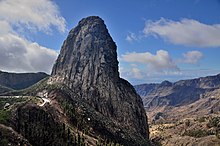
Garajonay National Park
Garajonay National Park is located in the center and north of the island of La Gomera, one of the Canary Islands (Spain). It was declared a national park in 1981 and a World Heritage Site by UNESCO in 1986. It occupies 40 km2 and it extends into each of the six municipalities on the island.
Read article
Top Questions
AI generatedMore questions
Nearby Places

La Gomera
Canary Island

Hermigua
Municipality in Canary Islands, Spain

Vallehermoso, Santa Cruz de Tenerife
Municipality in Canary Islands, Spain

Roque de Agando

La Gomera (DO)

Benchijigua
Place in Canary Islands, Spain

La Gomera (Parliament of the Canary Islands constituency)

La Gomera (Senate constituency)
Senate constituency in Spain


